Cahokia Mounds Group [Powell Mound] Showing the East St. Louis Mound Group and Big Mound [Patrick Map #3] [Post-Conservation]
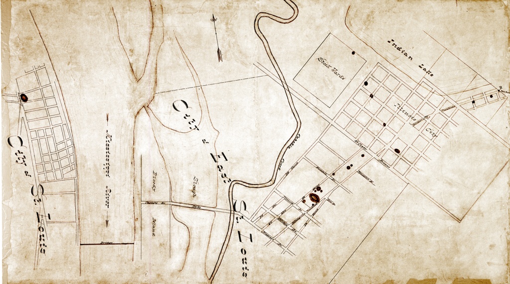
- Title
- Cahokia Mounds Group [Powell Mound] Showing the East St. Louis Mound Group and Big Mound [Patrick Map #3] [Post-Conservation]
- Description
- Map drawn with ink on light beige paper. Map centers on the parts of East St. Louis, Illinois and St. Louis, Missouri that face each other across the Mississippi River. Streets in East St. Louis are drawn, and some street names are labeled. On the St. Louis side, streets in the vicinity of Big Mound are drawn but street names are not given.
- Creator
- Patrick, J.J.R.
- Subject
- Cahokia Mounds
- East St. Louis Mound Group
- Big Mound
- Medium
- Image/map
- Format
- jpeg
- Date
- 1876
- Source
- Missouri Historical Society
- Identifier
- IDENTIFIER: N24023